Ever wonder what rocks you're standing on right now? What rocks are under your house? What rocks are found in your city?
You can use Google Earth to find out.
Here's how:
- Download Google Earth
- Download your state geologic map
- Open the map in Google Earth
- Find the town you're looking for
- Click on the geologic unit (color) covering your area
- A small box should pop up, describing what the rocks are
For example:
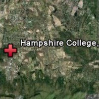
 | Here is my undergraduate college: Hampshire College in Amherst, Massachusetts.
The image is about 5 miles across, viewed from ~18 miles above.
|
Now I lay the state geologic map of Massachusetts over this:
 | The green parts represent Triassic New Haven Arkose: a reddish, sandy stone. The dark gray parts above the college are Ordovician Partridge Formation: mostly schists and amphibolites. The lighter gray parts are Devonian Littleton Formation: mostly schists and phyllites.
South of the college are Jurassic arkoses (grey-green), Jurassic Holyoke Basalt (brown), and Jurassic Berlin arkose (bright green). There are also a few major faults (black lines).
|
 | If I zoom out so my box is 22 miles across, I can see some of the larger geology of the area.
|


No comments:
Post a Comment